



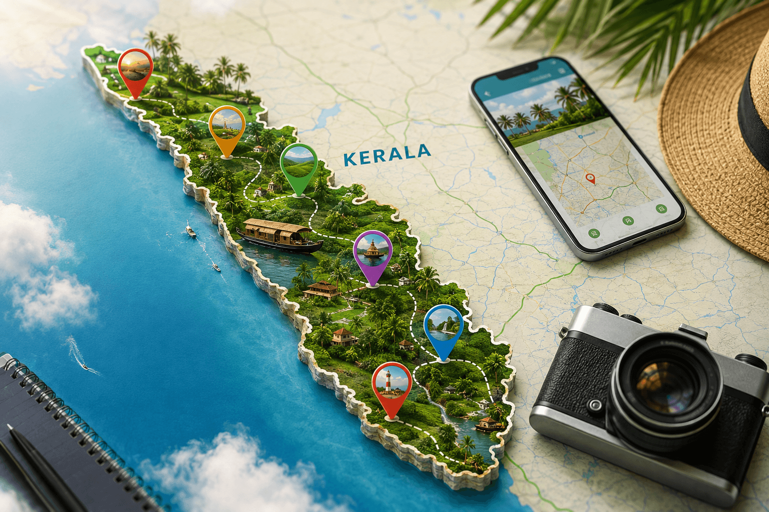
 Kerala Interactive Map
Kerala welcomes over 21 million tourists each year. Visitors flock to its 580 kilometers of Arabian Sea coastline and complex network of brackish canals. This varied geography demands careful route planning to prevent delays and exhausting detours.
Referencing an Interactive Kerala Travel Map: Plan Your Perfect Journey offers the easiest way to map your route before setting foot in the region.
A neat itinerary saves hours of transit on winding regional roads. This guide divides the land into distinct travel zones. Organizing your trip geographically ensures you experience both misty hills and sunny beaches without rushing.
Understanding Kerala’s Geography and Travel Zones
Traveling through Kerala requires grasping the sudden terrain shifts that happen over short distances. The region features three distinct elevation bands that shape local climates and road speeds. Recognizing these zones helps maintain a comfortable pace and avoids physical exhaustion.
By consulting an Interactive Kerala Travel Map: Plan Your Perfect Journey, you can map out these terrain shifts and set realistic expectations.
The misty highlands provide a cool escape, while the lowlands host the famous water networks. Driving between these zones means navigating narrow mountain passes with sharp curves. Reliable planning tools help you picture these elevation shifts before you depart.
| Region Zone | Elevation | Top Destinations | Suggested Stay |
|---|---|---|---|
| Highlands | Above 75 meters | Munnar, Wayanad, Thekkady | 3 to 4 Days |
| Midlands | 7.5 to 75 meters | Thrissur, Spice Plantations | 1 to 2 Days |
| Lowlands | Below 7.5 meters | Alappuzha, Kochi, Varkala | 4 to 5 Days |
Knowing how these regions connect ensures a smooth trip. We should look closely at how to handle the mountain roads safely.
Driving Through the Western Ghats Mountain Range
The Western Ghats mountain range marks the eastern border, boasting deep forests and sweeping views. Munnar rests around 1,600 meters above sea level, demanding slow uphill driving. The 130-kilometer trip from Kochi to Munnar takes at least four hours because of narrow mountain passes.
When plotting your route, relying on an Interactive Kerala Travel Map: Plan Your Perfect Journey helps you judge real driving times instead of raw distances.
Wayanad lies further north, featuring trekking trails and ancient caves. Driving through these high districts during the wet monsoon season demands extra care due to dense mist and slick roads. Visualizing these elevation drops protects your schedule from unrealistic timings.
Visitors should spend at least three days in the highlands to adapt to the cooler air. This timeframe allows for relaxed walks through national parks and tea factories. Leaving early in the morning helps you avoid heavy bus traffic on the mountain curves.
Exploring the Coast and Backwater Corridors
Lowland areas feature the famous backwaters, consisting of brackish lagoons and canals running along the Arabian Sea. Alappuzha serves as the main hub for houseboat tourism, where wooden boats glide down quiet channels. Houseboat trips cover 20 to 40 kilometers of waterways daily, starting from specific docks at exactly 12:00 PM.
Adding local ferry times and boat docks to your Interactive Kerala Travel Map: Plan Your Perfect Journey ensures smooth transitions from land to water. The coastal town of Varkala lies further south, featuring distinct red cliffs right next to the sea. This geological formation offers a sharp contrast to the flat sandy beaches of the north.
Coastal beaches are easy to reach by train, which runs parallel to the sea. The rail network links major coastal towns, providing a cheaper option than private taxis. Choosing public trains along the coast lowers your trip emissions.
- Alappuzha: Perfect for overnight houseboat trips and drifting through quiet village canals.
- Varkala: Known for coastal cliffs, mineral springs, and sunset viewing spots.
- Kovalam: Famous for its striped lighthouse and shallow waters suitable for swimming.
Cultural Centers of Central Kerala
Kochi remains the main entry point for international travelers arriving in South India. Historic Fort Kochi features 500-year-old architecture, including the oldest European church in the country. Visitors can watch historic Chinese fishing nets in action along the shore at sunset.
Marking these historic neighborhoods on your Interactive Kerala Travel Map: Plan Your Perfect Journey allows you to set aside enough time for walking tours. Thrissur sits slightly north of Kochi, serving as a cultural capital with historic temples and traditional art schools. This town hosts massive yearly festivals that draw thousands of visitors.
Major towns offer great dining options featuring traditional food served on banana leaves. Travelers can try local dishes like appam with vegetable stew or fresh pearl spot fish. Most high-quality restaurants sit close to historic districts, making them easy to reach on foot.
A Balanced Ten-Day Journey
A ten-day trip provides the perfect timeframe to experience these varied tropical landscapes. The smoothest route starts in Kochi, climbs east to Munnar, heads south to Thekkady, and finishes on the coast. This path avoids doubling back and ensures a smooth transition from hills to sand.
When tracking this loop on an Interactive Kerala Travel Map: Plan Your Perfect Journey, you will see the total driving distance is around 600 kilometers. Private taxis offer the most flexible transport option, costing around 40 to 50 US dollars per day. Hiring a local driver removes the stress of navigating unfamiliar mountain roads and local traffic habits.
- Days One and Two: Explore colonial heritage and art cafes in Fort Kochi.
- Days Three to Five: Travel to Munnar for tea garden walks and wildlife spotting.
- Days Six and Seven: See spice farms in Thekkady and join backwater boat rides in Alappuzha.
- Days Eight to Ten: Rest on the beaches of Varkala before heading back to Kochi.
Key Features of a Digital Route Planner
Modern digital maps offer clear benefits over paper guides by showing live traffic updates and exact coordinates. Travelers should choose platforms that work offline because mobile signals drop in deep mountain valleys. Saving offline maps of Munnar and Thekkady ensures you do not lose your driving directions.
Setting up custom layers on your Interactive Kerala Travel Map: Plan Your Perfect Journey turns a simple list of sights into a custom navigation guide. Users can color-code pins to tell mountain resorts apart from coastal homestays.
Shared maps allow travel partners to build the itinerary together. This shared planning ensures that everyone in the group has input on daily outings. Updated pins sync instantly, keeping all members informed of schedule changes during the trip.
Perfecting Your South Indian Trip
Planning a trip here requires looking closely at seasonal weather patterns. The dry winter months from October to March offer the most pleasant weather for outdoor walks. Planning your daily routes with geographic accuracy ensures you make the most of daylight hours during peak season.
Relying on a detailed Interactive Kerala Travel Map: Plan Your Perfect Journey ensures that you spend less time worrying about logistics and more time enjoying local culture. Seeing travel times, booking transit, and understanding local geography are the pillars of a successful trip. Travelers who use modern digital tools return home with great memories instead of travel stress.


Comments are closed